![]() |
| Venus 700 million years ago and now. Credit: NASA. |
Saturday, 10 April 2021
About Venus
Sunday, 4 April 2021
Mars Might Have Water Encapsulated Inside It's Crater
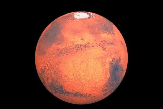
In my previous posts, I mentioned Jezero Crater in Mars and its similarities with Lake Salda in Turkey. In this post, I will be writing about how Mars is extremely similar to our world, Earth. In those posts, it was briefly mentioned that Mars once had water on its surface. Today Mars is extremely dry at first glance, this creates many questions such as what happened to the water on Mars's surface? Is it possible that one day Earth may have a similar change? I think with further investigations to Mars it would be possible to answer these questions.
There are some theories about where the water went such as a study that proposes that a combination of two mechanisms – the trapping of water in minerals in the planet’s crust and the loss of water to the atmosphere – can explain the observed deuterium-to-hydrogen signal within the Martian atmosphere. So water went nowhere, again a reference to the previous post about Jezero Crater, there was a moisturized section below the hard crust of Mars. Water is trapped in the crust, now another question might arise, why is the water encapsulated? This question will be answered when we have more data about the climate of Mars.
Scientist have examined yet another crater that has extreme similarities with an Earth lake. "They also noted the presence of a distinct set of ridges that face upward toward the crater wall, which bear a striking resemblance to ridges on Earth that formed at the edges of glaciers. "
A topographic map shows the raised ridges (dark yellow) and low-lying areas where water ponded (white). Credit: NASA/Boatwright et al./Brown University
For this reason, I think this is a very interesting topic when considering the world's climate is getting hotter by the day. Earth is very similar to Mars geologically, maybe they had similar climates. Maybe the data and information collected by the rovers would be somewhat beneficial for Earth's climate issues and how to prevent the Earth from becoming a dry crust with little to no life on it.
Sources:
https://www.sciencedaily.com/releases/2021/03/210316132106.htm
https://www.jpl.nasa.gov/news/new-study-challenges-long-held-theory-of-fate-of-mars-water
https://www.universetoday.com/150726/a-lake-in-a-martian-crater-was-once-filled-by-glacial-runoff/
Understanding BIM and It's Implementation in Our Jobs
This weekend, I attended a BIM Education seminar by Saniye Öktem and a Revit seminar by Tolga Arçok. For the people who are interested in this kind of stuff, I wanted to mention some highlights from the seminar. In the beginning, the image below was presented and some important differences were asked.
The most important thing that caught my attention was the VR headsets, this technology is being used in some firms to examine the building by simply putting on the headset and wander inside the structure. There are some pretty interesting gadgets as well and the environment looks very diverse and safe. I think this model is a great example, and with the technology we use I think this image is not so far away from reality.
BIM is a methodology that can enable safe, efficient, and sustainable construction site the image represents. Efficiency is obtained because every discipline can work with coordination in the same model. When exporting a model or data, there is no loss or misunderstanding because while using Revit, everything is assigned prior to it being included in the schedules. I think the construction process would be much more organized and revisions would decrease is BIM methodology is used.
There are many software's and add-ins that can be used with Revit, most outstanding ones in my opinion is firstly Advanced Steel and Robot Structural Analysis. Aside from them a program I found very impressive and advanced was TestFit. In this program, the user assigns the map location and the program generates example models. The models can be imported to Revit or another modeling program and can be later on adjusted and improved but it was pretty impressive seeing software generating a whole model. Here is a youtube video explaining;
Here is an article about BIM Methodology:
https://www.archdaily.com/957097/bim-methodology-for-the-creation-of-smart-buildings?ad_source=search&ad_medium=search_result_all
Friday, 26 March 2021
Using Numerical Methods to Examine Geotechnical Problems of Masonry Structures
![]() |
| Abu Serga Church |
![]() |
| 3D Finite Element discretization of the PLAXIS model and deformed generated mesh. References; |
Monday, 15 March 2021
Building on a Site That Is "Pretty Much a Pool", What to Consider?
In this post, I will be writing about an off-the-grid getaway house that would ideally be located near Medellin, Colombia. But the soil study shows that the site is almost like a pool, having a high water table and thick layers of loose soil. These properties would provide little to no capacity for supporting heavy objects. The ground is made of silty sand, any design would be at risk for seismically-induced settlement dues to liquefication which would cause vertical settlement and lateral spreading. Also, there were some clays present on the site, and if this clay type is expansive then during rainy seasons, clayey soil would cause swelling which would cause an unwanted movement.
![]() |
| Project Site |
The solution suggested was a floating slab- a flat layer of concrete resting on top of the soil, supported by vertical concrete piles beneath the outer edges. This solution has two problems;
1)It would damage the environment
2)Budget would be extremely high.
When local geotechnical engineers were consulted, two alternatives popped up. The first one was deep foundation. This foundation type involves driving long piles into the ground to reach the more stable layers of earth below. Another solution was ground improvement, which would reduce the damage caused by liquefication. This solution has many types; the first one would be the vibro-replacement stone column technique. Achieved by using a heavy vibrating weight to drill deep into the ground and create columns of compacted rock that support the earth around them. The second one would be deep soil mixing, achieved by using heavy equipment to mechanically combine weak soil and cementitious slurry. At this point, the design process is continuing since these solutions are not perfectly sustainable or safe for the site. Further exploration is being done to develop the design.
![]() |
| Eco Shelter Rendering |
![]() |
| Black and White Elevation Image |
Source:
Sunday, 14 March 2021
Impact Crater on Mars: Analyzing Its Morphology Using Slide2 and RS2
In my previous post, I mentioned the impact crater located on Mars. In this post, I will be talking about analyzing its morphology with software widely used by foundation engineers. This impact craters morphology is categorized as PPR (Peripheral Peak Ring). PPRs occur on craters having a diameter between 4 and 200 km when instabilities occur on the rim causing a crater deformation and a part of the rim to detach and slide into the crater. In the Department of Geoscience at the University of Calgary, there was a study to create a model for PPRS targeted to describe, characterize it. Jason Nycz, who was doing the research for this project, inversely modeled and analyzed the formation as a transversal block slide in Slide2 using the topographic inputs from DEM (Digital Elevation Models) and reasonable rock parameters. This research supplied much information about the strength parameters for the uppermost layers of the Martian crust. The model is created conditions and constraints (position, height, and shape of the crater) Three Phases of Modelling:
1. Modelling the crater before the PPR was formed.
2. Detachment of the PPR from the crater rim, sliding laterally and downward toward the crater center. The result is an intermediate step in the formation of the PPR.
3. Transform the intermediate profile into the observed one.
![]() |
| Initial input model in Slide2 |
![]() |
| Slide2 model imported to RS2 |
![]() |
| Finite element analysis results in RS2 |
References:
https://www.rocscience.com/documents/pdfs/rocnews/fall2011/Slope-Failure-Impact-Crater-on-Mars.pdf
Monday, 8 March 2021
Retaning Wall Collapsed During Foundation Excavations, the Building Next to the Construction Site Evacuated.
On 25 February 2021, a construction site in Artvin Borçka had an incident concerning retaining walls. The excavator that was digging the site was under the wreckage, but the operator managed to get out of the machine unharmed. Fortunately, no other person was injured. The building which had its retaining walls collapsed was evacuated for security reasons. Rigid walls used for supporting soil laterally so that it can be retained at different levels on the two sides are called retaining walls.

The most common reasons for failure are,
- lack of proper reinforcement
- improper drainage behind the wall
- foundation footing problems
- settlement expansion of the soil
- overloading the wall
- construction errors or other design errors.
For this case, the problem was caused by the excavator because they should have calculated the foundation that the retaining wall was settled in. At this point, they should either demolish the building or they should reinforce the wall with a curtain of piles of curtain grouting.

https://www.trthaber.com/haber/turkiye/artvinde-istinat-duvari-coktu-14-katli-bina-bosaltildi-559646.html
https://sites.google.com/site/metroforensics3/causes-of-retaining-wall-failure-or-collapse
Sunday, 28 February 2021
NASA’s Mars 2020 Perseverance Rover Chronicles: Jezero Crater and It's Importance
The Mars 2020 Perseverance rover is dropped on the Jezero Crater on Mars on 18 February 2021. This mission will be the first mission that is aiming to collect Martian rocks, this will help the scientists on Earth to characterize Mars' past climate, geology, and similarities with Earth. Jezero Crater is a 45-kilometer wide ancient impact crater located in the northwest corner of a larger impact basin on Mars. An impact crater is formed when an object like an asteroid or meteorite crashes into the surface of a larger solid object like a planet or a moon. Older investigations are suggesting that Mars was once a planet that contained rivers. This suggests that there was once life on this planet, at least some microbial life have lived in this crater is assumed because the rivers were connecting to this crater and might be carrying these life forms. An older rover that was sent to Mars has revealed that the crater contains clay and carbonate minerals. These minerals are similar to the ones at Lake Salda in Turkey. They share similar geology and mineralogy. Scientists are working on analyzing Lake Salda to have an idea of what will be important to consider when analyzing the crater and overall conditions at Mars. It is not certain that they will be faced with the same results but it's a high possibility.
![]() |
Source: Mars Exploration Image Gallery, 2011 |

Tuesday, 10 December 2019
![]() |
| A Wall In DB |
![]() |
| Wall of the G block lounges |
Question 2: Explain how they are an example of a pattern, are they based on repetiton? Compare them in the design qualities based on repetition.
| A wood piece below a light in the ceiling of DB |
![]() |
| A sieving machine for aggregates |
Question 3: Discuss the images, how structural and and tectonic qualities become expressive character of the design.
![]() |
| A chair in G block |
![]() |
| Tree locaed in the backyard of G block |