Showing posts with label Mars. Show all posts

Sunday, 4 April 2021

Mars Might Have Water Encapsulated Inside It's Crater

In my previous posts, I mentioned Jezero Crater in Mars and its similarities with Lake Salda in Turkey. In this post, I will be writing about how Mars is extremely similar to our world, Earth. In those posts, it was briefly mentioned that Mars once had water on its surface. Today Mars is extremely dry at first glance, this creates many questions such as what happened to the water on Mars's surface? Is it possible that one day Earth may have a similar change? I think with further investigations to Mars it would be possible to answer these questions.  
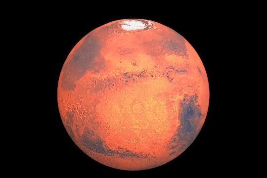
There are some theories about where the water went such as a study that proposes that a combination of two mechanisms – the trapping of water in minerals in the planet’s crust and the loss of water to the atmosphere – can explain the observed deuterium-to-hydrogen signal within the Martian atmosphere. So water went nowhere, again a reference to the previous post about Jezero Crater, there was a moisturized section below the hard crust of Mars. Water is trapped in the crust, now another question might arise, why is the water encapsulated? This question will be answered when we have more data about the climate of Mars. 

Scientist have examined yet another crater that has extreme similarities with an Earth lake. "They also noted the presence of a distinct set of ridges that face upward toward the crater wall, which bear a striking resemblance to ridges on Earth that formed at the edges of glaciers. " 

A topographic map shows the raised ridges (dark yellow) and low-lying areas where water ponded (white). Credit: NASA/Boatwright et al./Brown University

For this reason, I think this is a very interesting topic when considering the world's climate is getting hotter by the day. Earth is very similar to Mars geologically, maybe they had similar climates. Maybe the data and information collected by the rovers would be somewhat beneficial for Earth's climate issues and how to prevent the Earth from becoming a dry crust with little to no life on it. 

Sources:

https://www.sciencedaily.com/releases/2021/03/210316132106.htm

https://www.jpl.nasa.gov/news/new-study-challenges-long-held-theory-of-fate-of-mars-water

https://www.universetoday.com/150726/a-lake-in-a-martian-crater-was-once-filled-by-glacial-runoff/

Sunday, 14 March 2021

Impact Crater on Mars: Analyzing Its Morphology Using Slide2 and RS2

In my previous post, I mentioned the impact crater located on Mars. In this post, I will be talking about analyzing its morphology with software widely used by foundation engineers. This impact craters morphology is categorized as PPR (Peripheral Peak Ring). PPRs occur on craters having a diameter between 4 and 200 km when instabilities occur on the rim causing a crater deformation and a part of the rim to detach and slide into the crater. In the Department of Geoscience at the University of Calgary, there was a study to create a model for PPRS targeted to describe, characterize it. Jason Nycz, who was doing the research for this project, inversely modeled and analyzed the formation as a transversal block slide in Slide2 using the topographic inputs from DEM (Digital Elevation Models) and reasonable rock parameters. This research supplied much information about the strength parameters for the uppermost layers of the Martian crust. The model is created conditions and constraints (position, height, and shape of the crater) Three Phases of Modelling:

1. Modelling the crater before the PPR was formed. 

2. Detachment of the PPR from the crater rim, sliding laterally and downward toward the crater center. The result is an intermediate step in the formation of the PPR.

3. Transform the intermediate profile into the observed one.

Initial input model in Slide2


Slide2 model imported to RS2


Finite element analysis results in RS2


References:

https://www.rocscience.com/about/news-events/ocscience-goes-to-mars-using-slide2-and-rs2-to-advance-research-on-impact-crater-morphology

https://www.rocscience.com/documents/pdfs/rocnews/fall2011/Slope-Failure-Impact-Crater-on-Mars.pdf

Sunday, 28 February 2021

NASA’s Mars 2020 Perseverance Rover Chronicles: Jezero Crater and It's Importance

The Mars 2020 Perseverance rover is dropped on the Jezero Crater on Mars on 18 February 2021. This mission will be the first mission that is aiming to collect Martian rocks, this will help the scientists on Earth to characterize Mars' past climate, geology, and similarities with Earth. Jezero Crater is a 45-kilometer wide ancient impact crater located in the northwest corner of a larger impact basin on Mars.  An impact crater is formed when an object like an asteroid or meteorite crashes into the surface of a larger solid object like a planet or a moon. Older investigations are suggesting that Mars was once a planet that contained rivers. This suggests that there was once life on this planet, at least some microbial life have lived in this crater is assumed because the rivers were connecting to this crater and might be carrying these life forms. An older rover that was sent to Mars has revealed that the crater contains clay and carbonate minerals. These minerals are similar to the ones at Lake Salda in Turkey. They share similar geology and mineralogy. Scientists are working on analyzing Lake Salda to have an idea of what will be important to consider when analyzing the crater and overall conditions at Mars. It is not certain that they will be faced with the same results but it's a high possibility. 


Figure.1 Eroded Layers in Shalbatana Valles
Source: Mars Exploration Image Gallery, 2011

A comparison between Lake Salda and Jezero Crater: 
 

You can watch the route of the rover, and overall a detailed explanation of the mission in the video below: